Snow Returns to New England and Northeast as Nor'easter Brings Cold Rain
A developing nor'easter brings the first snow of the season to high elevations of New England and the Adirondacks, while coastal cities face cold rain and gusty winds through Friday.

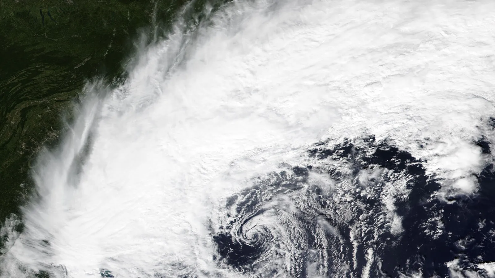
A developing nor'easter is set to bring the first snow of the season to higher ground across the Northeast United States, while cities along the Interstate 95 corridor face a cold, windy rain from Thursday into Friday. Forecasters say several inches of wet snow are possible in the mountains of Massachusetts, Vermont, New Hampshire and Maine, with the storm strengthening as it moves off the Mid-Atlantic coast.
Where the snow will fall
Forecasts call for a coating to about 3 inches of wet snow in higher-elevation spots across the Berkshires, northern Worcester County, and most of Vermont, New Hampshire and Maine. Isolated peaks could see 3 to 6 inches. New York's Adirondack Mountains and Vermont's Green Mountains have the best chance of heavier totals, according to CNN, which put the range at 2 to 6 inches.
Because the snow is wet and heavy, forecasters warn it could break tree limbs and cause isolated power outages in those areas. Some flakes may also reach lower elevations of the interior Northeast and mix with rain, but little accumulation is expected there.
Rain for the coast and lower ground
For Greater Boston, southeastern Massachusetts, Cape Cod, Rhode Island and most of Southern New England, the main impact will be rain. The Boston Globe forecast about half an inch of cold, windswept rain for the city, far less than the rainfall seen there last week. Coastal flooding is not expected to be a major issue this time, though minor tidal flooding is possible at high tide on Thursday and Friday along parts of the New Jersey coast and southwest Connecticut.
In northern New Jersey, forecasters expect around an inch of rain, while the southern half of the state may see a quarter to half an inch. Thunder is possible along the coastal plain late Thursday night and early Friday, and some wet flakes may mix in across northwestern New Jersey, though no accumulation is expected there.
Wind and a sharp drop in temperatures
Gusty conditions will begin Thursday afternoon and continue through much of Friday. Wind gusts along the New England coast are expected to reach 20 to 30 mph, while northwest gusts of 20 to 25 mph are forecast for New Jersey on Friday.
The storm will also usher in the coldest air since spring for many people east of the Mississippi River, according to CNN. Temperatures are expected to run 5 to 15 degrees Fahrenheit below average in many areas. In New Jersey, daytime highs are expected to stay in the 40s on Friday and Saturday, with overnight lows in the 20s to low 30s and a likely first freeze for parts of southern New Jersey.
What comes next
Forecasters expect the storm to wind down Friday night, with a few lingering snow showers or rain before tapering off on Saturday morning. Drier weather is expected for much of the weekend and into the middle of next week in New Jersey, while the Boston area may see only light, non-sticking flakes on Saturday. Forecasters caution that snow totals could come in slightly below predictions because wet flakes and ground melting may limit accumulation.
Temperatures are expected to moderate next week across much of the eastern half of the country, with above-average readings forecast by CNN. The first measurable snow in Boston is typically expected around December 11, according to The Boston Globe, and forecasters suspect the city will still be waiting for that first inch after this storm passes.
Shorter storm forecasts can change, and the track of the storm center will determine how much rain and snow falls in each area.
Forecasts are subject to change as the storm develops.